Helicopter and aerial lidar, photography and photogrammetric mapping for engineers, developers, utilities and energy companies across the Southeast and the Caribbean.
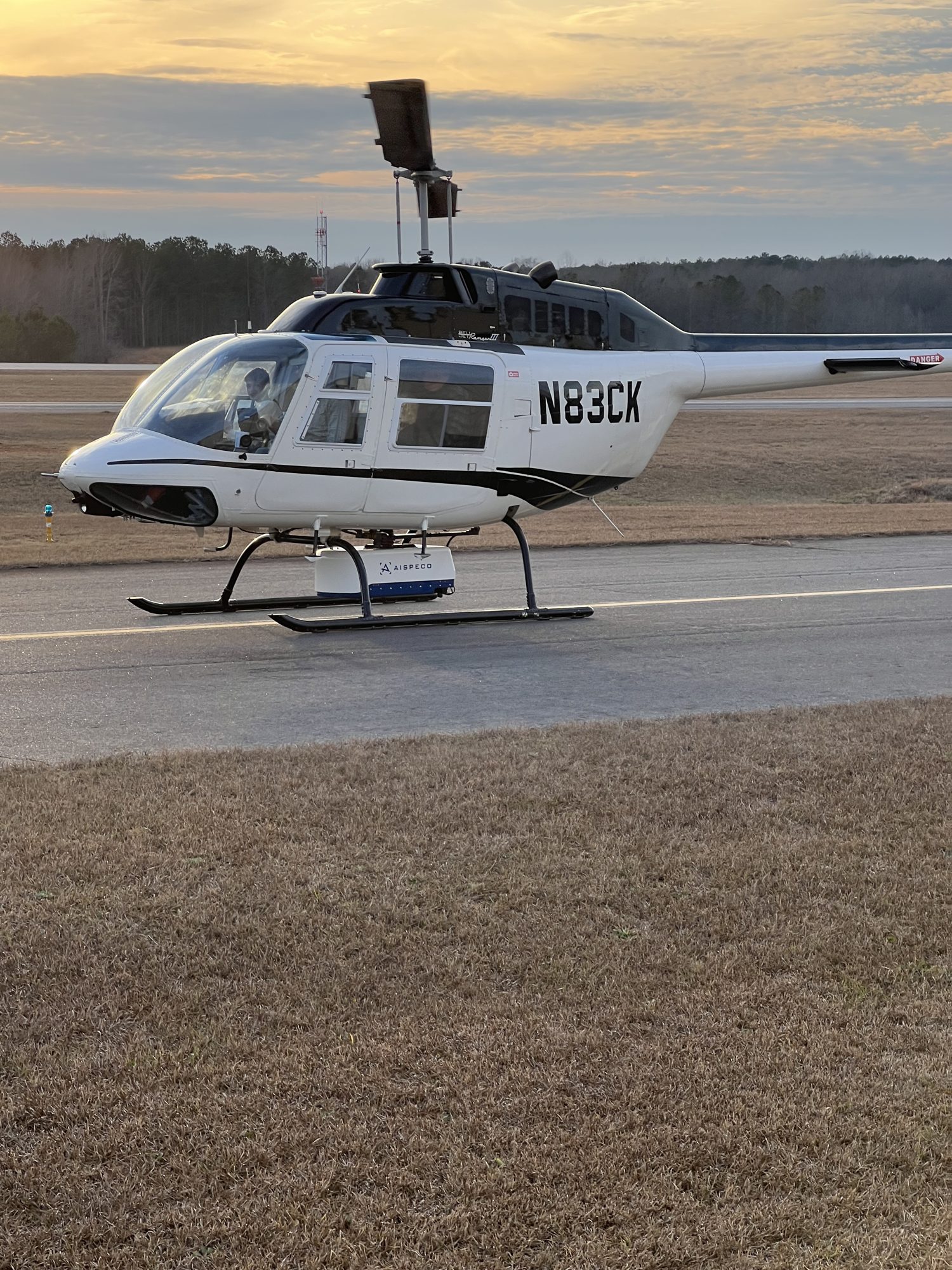
Our lidar-equipped Bell 206 flies overlapping flight lines over the corridors and sites we map most: transmission lines, pipelines, solar farms and roadways. Every laser return becomes a measured, classified point.
Planned, overlapping flight lines at survey altitude.
Laser pulses measure the ground, structures and wires, even under canopy.
Classified point clouds, DEMs, contours and orthos.
We are a forward-thinking aerial surveying and mapping firm with over 50 years of professional experience — delivering reliable, smart solutions while maintaining project quality, accuracy and timeliness.
High-resolution imagery and dense lidar collected by manned aircraft.
02Topographic mapping, contours and surfaces ready for design.
03UAV lidar and imagery for smaller and fast-turnaround sites.
04Accurate, map-ready imagery without building lean.
05Transmission, pipeline and roadway corridors mapped end to end.
063D models and oblique views for planning and communication.
07Vehicle-mounted lidar for roads, rail and infrastructure.
08Airspace and obstruction data for airport projects.
Classified lidar point cloud of a transmission structure and corridor, colored by elevation. Engineer-ready data for design, clearance and asset management.
Utility-scale solar, storage and transmission projects need fast, accurate site data. Our helicopter and fixed-wing crews cover hundreds of acres per flight.

Our helicopter platform flies low and slow over corridors, solar sites and tight project areas, capturing dense, high-accuracy point clouds and imagery that fixed-wing collection can miss.
Since 1966 we have grown from a traditional photogrammetric mapping firm into a fully digital geospatial service company. We pride ourselves on being responsive, efficient and attentive to our clients' needs, and we keep investing in the latest geospatial technology — so any size project gets the same care and professionalism.
Our clients: land developers, surveyors, engineers, geospatial firms and energy companies.
302 Dividend Dr, Peachtree City, GA 30269 · 770-487-7814